Seafloor mapping is a specialized tool that is used by scientists to peer into the ocean. This Surveying helps them learn what is under the water. Mapping the seafloor aids scientists in improving their understanding of the ocean and discovering new stuff lurking beneath the surface.
Seafloor mapping is doing maps of the ocean, so it's really important for scientists By mapping the seafloor, scientists can figure out where there might be mountains or valleys or even volcanoes hidden under the sea. This subsea control system is vital information for sailors, fishermen, and submarines, who must understand what is beneath the water.
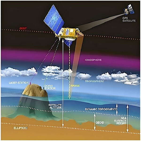
For seafloor mapping to perform well, it requires advanced technology. One of the Seaward subsea equipment scientists have is called a multi-beam echo sounder.
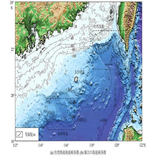
Seafloor mapping is also important for ocean protection. Mapping the seafloor can help determine where marine life thrives, including critical marine habitat such as coral reefs and seamounts. This enables them to defend these habitats against pollution and overfishing, so marine life can flourish in the ocean.
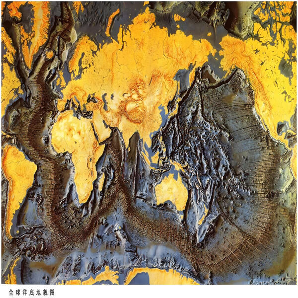
Scientists have made amazing discoveries about the ocean using seafloor mapping.
Seaward Technology is known for its high-precision, reliable products, including deep-sea pressure sensors, underwater robots, and sonar systems. Our equipment is ISO 9001 certified and rigorously tested to ensure stable performance in extreme deep-sea environments, such as high pressure and low temperatures. We offer tailored solutions, adjusting equipment parameters to meet specific project needs. By choosing Seaward, you partner with a company committed to providing high-performance, customized solutions for your marine exploration projects.
Seaward Technology invests 15% of its annual revenue into research and development, advancing marine survey technology. In collaboration with leading global research institutions, we develop next-generation equipment, such as intelligent underwater robot tools and optical communication devices. Our R&D team regularly publishes technical white papers on emerging trends and innovations. By staying at the cutting edge, we ensure our customers receive solutions that keep them ahead in the rapidly evolving marine exploration industry.
Seaward Technology excels in delivering customized solutions to meet the specific requirements of diverse marine exploration projects. Whether it’s adjusting equipment parameters for specialized tasks or offering bespoke configurations, our team ensures optimal performance. Our products are rigorously tested in extreme conditions, ensuring reliability in deep-sea environments. With Seaward, you get precisely tailored solutions that perform under the most demanding conditions, ensuring success in your specialized marine ventures.
Seaward Technology has a global service network with branches in Canada, mainland China, and Hong Kong, providing localized support to meet the needs of our international clients. We understand the challenges of working in diverse environments and offer timely delivery, expert technical assistance, and local support. Our products offer superior performance at competitive prices, providing outstanding value. Additionally, we offer unique technologies that are not available from other suppliers, ensuring you receive exclusive solutions for your marine projects.